|
|
|

|
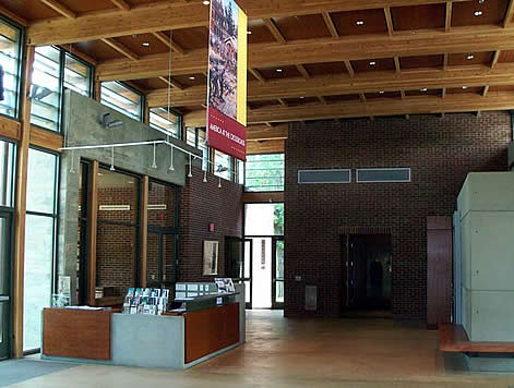
For six months in 1862, Corinth, a critical railroad junction and second only to Richmond in military importance, captured the full attention of a divided nation. Today, one of the National Park Service's newest visitors centers, interprets the key role of Corinth in the Western Theatre of the American Civil War. The 15,000 square foot facility features interactive exhibits, a multi-media presentation of the Battle of Shiloh and the Battle of Corinth. The center stands near the site of Battery Robinett, a Federal fortification where some of the bloodiest fighting of the Battle of Corinth took place. An obelisk stands in tribute to Colonel William P. Rogers of the 2nd Texas Infantry, who showed great bravery attempting to climb the walls of the Battery to claim it for the Confederacy. Four unknown Confederate soldiers are also buried at the site. Visitors reach the center by ascending a walkway strewn with bronze replicas reflecting the aftermath of battle. At the building's entrance, visitors pass six bronze Civil War soldiers marching into the Center at double-quick. On the grounds, full scale reproductions of earthworks explain the importance of field fortifications. An extensive courtyard exhibit is home to a water feature commemorating two hundred years of American history. The Center also houses a seventy-five seat auditorium, public research library, and a gift shop/bookstore.
See
more photos & video
|
|
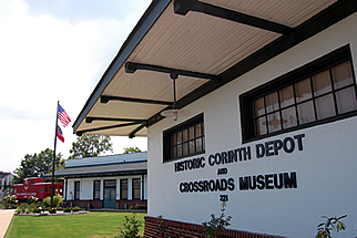
Serving as the hub of historical information for the area, the Crossroads Museum features permanent exhibits featuring authentic Civil War relics and railroad memorabilia. The Museum is situated near the crossroads of two railroads. The crossing of the then Memphis & Charleston and the Mobile & Ohio, catapulted Corinth into the national spotlight during the early years of the War. These railroads were the only two major standard gauge railroads in the Confederacy and were important for communication and supply lines. Today the active freight lines sit in the same beds as those from 150 years ago. Visitors may also get a glimpse of the historic crossroads from the safety of the Museum's interior gallery.
See
more photos & video
|
|
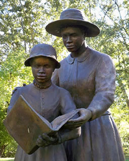
Many African Americans who fled Southern plantations and farms seeking freedom and protection found the Federally occupied Corinth to be a secure location. Union General Grenville Dodge understood what effect the defection of thousands of African- Americans would have on the Confederate War effort. He began to enlist the escaped slaves who came into his lines as teamsters, cooks, and laborers. He actively recruited male refugees, armed them, and placed them in charge of security at the newly organized contraband camp in Corinth. Dodge's refugee administrative efforts led to the formation of the 1st Alabama Infantry Regiment of African Descent, consisting of approximately 1,000 men. Under the supervision of Chaplain James M. Alexander of the 66th Illinois Volunteer Infantry, the Corinth camp resembled a small town, complete with a church, commissary, hospital, both frame and log houses, and a street grid with named and numbered houses. An American Missionary Association School operated where eager students of all ages sought knowledge day and night. Today, a portion of this camp has been set aside to commemorate the events with changed the lives of so many people. Bronze figures surround the trail through the camp depicting the lives of these people once considered "contraband" of war.
See
more photos & video
|
|
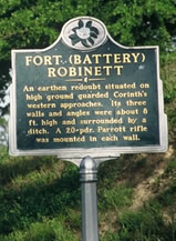
Corinth's Civil War Earthworks (Battery F, Beauregard Line & Fort Battery Robinett)
Simply put, the earthworks were constructed to protect the defenders from an attacking foe. Some were built by the Confederates, others by the Union. Slaves, contrabands and soldiers using shovels and picks, moved hundreds of thousands of tons of earth to construct the rifle pits, forts and artillery positions. The placement of the earthworks was carefully selected to take advantage of the topography and the design and West Point trained engineers supervised construction. The fortifications were laid out with military precision and the adjacent forests were cut down to provide unobstructed fields of fire. Lined up end to end, these earthworks would have stretched for an incredible 41 miles of which only 7.5 miles remain. The earthworks in and around Corinth are rare examples of the fortifications used early in the war. Hastily built, these works are among the most impressive and awe inspiring in the United States. The majority of the earthworks were built between March and October of 1862 and represent four distinct phases of construction. First was the "Beauregard Line" named for General Pierre G. T. Beauregard, which was built by the Confederates from March thru May to protect the city from attack from the north and east. The Union siege lines, constructed in May, protected the advancing Northern armies from surprise attacks. In June and July Union soldiers constructed six forts, designated A thru F to extend the captured Confederate earthworks completely around the city. This was known as the "Halledk Line," named for Major General Henry W. Halleck, commander of the Union armies. The "Rosecrans Line," composed of seven small forts, was constructed close to the railroad crossing and was designed to be defendedby a small garrison of soldiers. This line was named for Major General William S. Rosecrans who commanded the Federal army during the Battle of Corinth, October 3 & 4, 1862. Today, the earthworks stand under the cool shade of protective hardwood groves. The trees provide a shield from the rain and the potentially destructive forces of erosion. The precise angles have been softened but even the casual observer can still see the remarkable walls and rifle pits. All of the earthworks are well marked and have parking spaces or pull-offs and many offer racks for locking bicycles. A few of the sites are easily accessible though most require a walk of from several hundred yards up to a mile. Well-marked paths lead to the sites, and most have informative way side exhibits describing the individual earthworks.
See
more photos & video
|
|
Colonel Rogers, known as the hero of Battery Robinett, was mortally wounded in fighting on the second day of the Battle of Corinth, October 4, 1862. Federal General William Rosecrans ordered Colonel Rogers buried where he fell, an eternal reminder of Rogers' ultimate sacrifice. In 1896, the Albert Sidney Johnston Camp #1164 of The United Confederate Veterans had the statue erected to honor their comrades and leader Colonel Rogers. The Statue, which once stood in the intersection of Waldron and Frankin Streets, is now over 100 years old and stands on the corner of the Alcorn County Court Square.
See
more photos & video
|
|
Historic
Verandah/Curlee House
The house has serious structural problems, particularly with the roof and foundation. The Friends of the Siege and Battle of Corinth, a local, non-profit, battlefield preservation group, is seeking public and private funding for the projected $2 million renovation. Donations may be made to the Friends of the Siege and Battle of Corinth, Post Office Box 245, Corinth, MS. 38835. The Verandah/Curlee House Preservation Commission holds the annual Corinth Home & Garden Tour . All proceeds from the tour are donated to the preservation of the Verandah/Curlee House.
See
more photos & video
|
|
The Corinth National Cemetery, located on Horton Street, was founded in 1866 and is the final resting place for 1,793 known and 3,895 unknown soldiers representing 273 regiments from 15 states. The process of consecrating remains was begun in September 1864. The remains were garthered from some fifteen or twenty battlefields or skirmish grounds from Corinth, Iuka, Holly Springs, Guntown and Farmington, Mississippi. By 1870, when the interment program was practically completed, Corinth was number sixteen in the order of National Cemeteries having 5,688 interments.
Address:
1551 Horton Street, Corinth, MS. 38834 -
Map
it
|
|
On 4,000 acres overlooking the Tennessee River, 151 monuments, 217 cannon, and over 450 historic tablets mark America's best preserved battlefield, the site of the Civil War's first major combat in the western theatre. Fought April 6, 7, 1862, the Battle of Shiloh (Pittsburg Landing) gave Federal General U.S. Grant his sternest test and witnessed the death of Confederate General Albert Sidney Johnston, the highest ranking American ever killed in combat. A ten-mile, self guided driving tour begins at the Visitors Center, which features an orientation file and interpretive exhibits. Ranger lead programs are given seasonally.
Address:
1055 Pittsburg Landing Road. Shiloh, TN. 38376 - Map it
|
|
On the morning of June 10, 1864, Federal and Confederate troops clashed near Baldwyn at Brice's Crossroads. Confederate General Nathan Bedford Forrest led elements of his cavalry corps in a bloody day-long battle against a much larger Federal Army commanded by General Samuel Sturgis. Fighting in sweltering heat, Forrest used his superior knowledge of the enemy, aggressive tactics and favorable terrain to win one of the most decisive battles of the Civil War. Today the battlefield contains monuments and interpretive panels on a small one acre plots at the crossroads. Local preservationist have secured more of the battlefield land and opened a 3000 square foot visitors center which features artifacts and detailed model of the battlefield.
Address: 607
Grisham Street, Baldwyn, MS. 38824 -
Map
it
|
|
On the morning of July 14, the Battle of Tupelo began when Confederate troops began a series of uncoordinated attacks against the Federal position. These attacks were beaten back with heavy losses. Failing to break the Federal center, the Confederates attacked the Federal right, again without success. After dark, the Confederates made another attack from the south without significant effect. Although Federal troops had repulsed several Confederate attacks, the Federal leaders were alarmed. Their supplies were running low. On July 15, after skirmishing with Confederates on the western and southern fronts, the Federals began marching north in the direction of Memphis. They marched four miles and crossed to the north side of Old Town Creek and camped in the late afternoon. In the evening, Confederate forces surprised these troops with artillery and infantry fire. The Federals scrambled and formed a line that pushed the Confederates off the ridge and forces them to retreat to Harrisburg. The grounds of the Tupelo Battlefield are open to the public everyday. Visitors are welcome to learn more about the Battlefield at the Natchez Trace Parkway Visitors Center.
Address:
2680 Natchez Trace Parkway, Tupelo, MS. 38804 -
Map
it
|
|
The Battle of Davis Bridge is often referred to as the third day of the Battle of Corinth. It was there that forces of three brigades under Federal General E.O.C. Ord, enroute from Bolivar to Corinth, seized high ground to the east and turned aside the Confederate Army of West Tennessee, retiring to Holly Springs after its abortive attack on Corinth. Overall Federal casualties were 570. The Confederates crossed the Hatchie at Crum's Mill six miles to the south.
Address:
TN Highway 57 in Hardeman and McNairy County, TN. -
Map
it
|
Home | Coming Events | Places to Visit | Tours | Photos & Video | History | In Their Own Words | Contact
web design byzacksteen.com


 Corinth
Civil War Interpretive Center
 Crossroads
Museum at the Historic Corinth Depot
 Corinth
Contraband Camp
 The
City of Corinth offers visitors a multitude of Civil War related
sites but none as impressive as the extant earthworks, which have
survived not only military engagements, but the battles of time
and development as well. They once encircled the city, protecting
the vital railroad junction from advancing armies. Today they
can be found in neighborhoods and wooded lots, a tangible reminder
of another time.
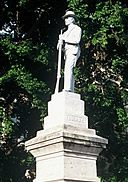 Statue
of Colonel William P. Rogers at Alcorn County Court Square
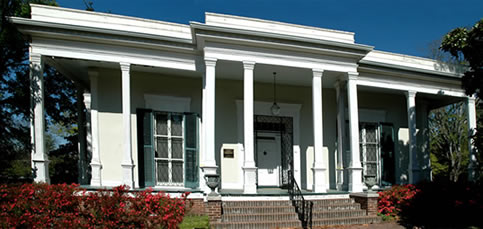 Originally
built in 1857 for city of Corinth co-founder Hamilton Mask, the
Verandah-Curlee House served as headquarters for several generals
during the Civil War. The house was purchased in 1875 by Mrs.
Mary E. Curlee, mother of Shelby Curlee - founder of nationally
famous Curlee Clothing Co. - upon her husband's death in 1878.
The house changed ownership twice for very brief periods of time
before being bought by Leroy Montgomery Huggins. The Huggins occupied
the home until 1921 when Shelby Hammond Curlee purchased the home
again for his sister, Neil. The Curlee family of St. Louis, MO.,
gave the home to the City of Corinth in 1960. The home is a designated
National Historic Landmark.
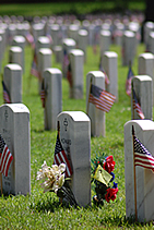 Corinth
National Cemetery
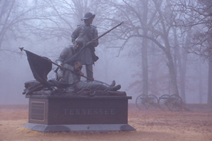 Shiloh
National Military Park
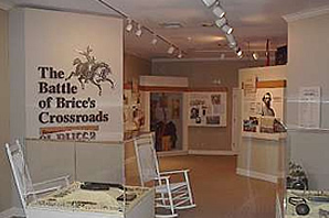 Brice's
Crossroads
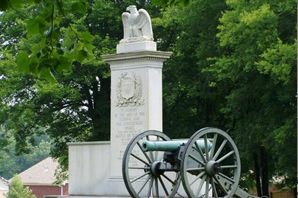 Tupelo
National Battlefield
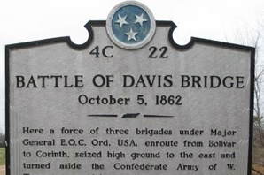 Battle
of Davis Bridge